Russia has spent three hundred years trying to reach a port that does not freeze. Britain became a naval empire because it is an island. Mountains made Switzerland neutral and Afghanistan unconquerable. Leaders come and go. The rivers stay where they are.
How much of a nation's destiny is decided by its location?
Before you ask why a country acts as it does, look at what is on its borders.
Watch it in four minutes.
What it is, in plain words.
- 18 lessons
- 11 modules, each with a test
- 9 people explained
- 156 works, places and ideas explained
- 12 question final exam
Geography studies where things are and why. Physical geography covers land, water and climate. Human geography covers where people live, work and move. Geopolitics is what happens when states pursue power on that uneven ground.
Location is fate more often than leaders admit. Rivers and ports decide where cities grow. Mountains, deserts and seas decide which borders hold. Resources such as oil, fresh water and farmland sit in some countries and not others. Narrow sea lanes carry most of the world's trade and can be closed. Maps themselves are arguments, since every projection and every drawn border serves someone. Before judging a country's behaviour, find it on a map and look at its neighbours and its coastline.
Five ideas to hold
A narrow passage, such as a strait or canal, through which a large share of trade must pass.
Much of world trade passes through a handful of narrow waterways. The Strait of Hormuz carries a large share of the world's seaborne oil. The Strait of Malacca links the Indian and Pacific oceans. The Suez and Panama canals save ships thousands of miles. Because each can be blocked, they are guarded, fought over and watched closely. A single grounded ship closed the Suez Canal for six days in 2021 and delayed billions of dollars of goods.
A weaker country lying between two rivals, which reduces direct friction between them.
A buffer state sits between two stronger rivals and keeps them from sharing a border. Afghanistan served that purpose between the Russian and British empires in the nineteenth century. Belgium was meant to do so between France and Germany. The position is precarious. The buffer survives while both neighbors prefer it neutral, and it is often the first place invaded when they stop. Many of today's contested territories began as buffers.
A material from the earth that has economic value, such as oil, minerals or water.
Oil, gas, minerals, timber, farmland and fresh water are unevenly spread, and that shapes wealth and conflict. Resources do not guarantee prosperity. Many resource-rich countries grow slowly and suffer corruption, a pattern called the resource curse, because easy income weakens the need to build other industries or answer to taxpayers. Norway avoided it by saving its oil income in a national fund. New technology shifts which resources matter, as lithium and rare earths now show.
The movement of people from the countryside into cities.
In 1800 fewer than one person in ten lived in a city. Today more than half do, and the share is still rising, fastest in Africa and Asia. People move for work and services. Cities are more productive than the countryside, since ideas and trade concentrate there, and they are also where pollution, congestion and housing shortages concentrate. How well fast-growing cities are planned is among the largest practical questions of this century.
A method of showing the round Earth on a flat sheet. Every method distorts size, shape or distance.
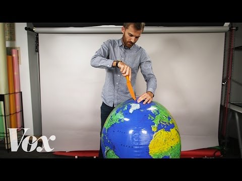
A sphere cannot be flattened without stretching it somewhere. The Mercator projection of 1569 keeps compass directions straight, which sailors needed, and in exchange it inflates areas near the poles. Greenland appears as large as Africa, which is in fact about fourteen times bigger. Other projections preserve area and distort shape. Every map is a choice about what to get right and what to sacrifice, and the choice shapes how people picture the world.
Five moments that made the field
- c. 240 BCEratosthenes measures the size of the Earth with shadows.
- 1569Mercator publishes the map projection sailors will use for centuries.
- 1869The Suez Canal opens and shortens the route from Europe to Asia.
- 1884Greenwich is chosen as the prime meridian.
- 1904Halford Mackinder argues that whoever controls the heart of Eurasia controls the world.
Still argued about
How far does geography decide a nation's fate?
Who should control the Arctic as its ice melts?
Should borders drawn by old empires be kept?


Three facts, one myth, one dare.
Maps show the world as it is.
Tap to turn it overEvery flat map distorts something. The familiar one inflates the north.
Draw a world map from memory, then compare.
11 sections, 18 lessons.
- 1
The briefing
Choke point · Buffer state · Natural resource · Urbanization
- 2
Introduction to Geography and Geopolitics
Definition and Scope of Geography · Definition and Scope of Geopolitics · Historical Evolution of Geopolitical Thought · Conclusion
- 3
Physical Geography
Earth's Structure and the Plate Tectonics Theory · Climate Zones and Weather Patterns · Biodiversity and Ecosystems
- 4
Human Geography
Population Distribution and Demographics · Urbanization and the Structure of Cities · Cultural Landscapes and Cultural Geography · Economic Geography: Global Trade and Commerce
- 5
Geopolitical Theories and Concepts
Classical Geopolitics: Heartland and Rimland Theories · Critical Geopolitics: Constructing Political Spaces · Geostrategy: Military Geography and Security · Environmental Geopolitics: Resources and Sustainability
- 6
Global Geopolitical Dynamics
Major Powers and their Geopolitical Interests · Emerging Economies and Shifting Power Balances · Conflict Zones and Hotspots: Case Studies · Economic Sanctions, Trade Wars, and Diplomacy
- 7
Regional Studies
North America: NAFTA and USMCA · Europe: EU Politics and Eastern Europe · Asia: Rise of China, South China Sea Disputes · Middle East: Oil Politics, Israel-Palestine Conflict
- 8
Geopolitical Implications of Climate Change
Global Warming and Environmental Degradation · Water Scarcity and Resource Management · Migration and Climate Refugees · International Agreements and Policies (Paris Agreement, etc.)
- 9
Technology and Geopolitics
Space Exploration and Satellite Technology · The Internet and Data Sovereignty · Emerging Technologies: AI, Drones, Cybersecurity
- 10
Future Trends and Challenges
Globalization vs. Nationalism · The Arctic: A New Geopolitical Frontier · Geopolitical Implications of Pandemics and Health Crises · Ethical Considerations in Geopolitics
- 11
Conclusion
Summary of Key Points · The Role of Geopolitics in Shaping the Future · Further Reading and Resources
Location is fate more often than leaders admit. Rivers and ports decide where cities grow. Mountains, deserts and seas decide which borders hold. Resources such as oil, fresh water and farmland sit in some countries and not others. Narrow sea lanes carry most of the world's trade and can be closed. Maps themselves are arguments, since every projection and every drawn border serves someone. Before judging a country's behaviour, find it on a map and look at its neighbours and its coastline.
People to know.
The Heartland theory
Sea power
Measured the Earth
Founder of modern geography
Books to read.
- Prisoners of GeographyTim Marshall
- The Revenge of GeographyRobert Kaplan
- Guns, Germs, and SteelJared Diamond
A question from its final exam.
The Heartland theory was proposed by
9 people, each one explained.
Twelve of them are below. In the Atlas every name, work and place in the text opens a short account of who or what it is.
 Nicholas Spykman 1893 to 1943
Dutch-American geopolitician Sir Halford Mackinder 1861 to 1947
British geographer, academic and politician Alfred Thayer Mahan 1840 to 1914
United States Navy admiral and historian Friedrich Ratzel 1844 to 1904
German geographer and ethnographer Karl Haushofer 1869 to 1946
German philosopher- Klaus Dodds born 1969
British academic  Robert D. Kaplan born 1952
American writer Wladimir Köppen 1846 to 1940
German meteorologist Zbigniew Brzezinski 1928 to 2017
Polish-American diplomat and political scientist


Descriptions and dates from Wikidata. Portraits from Wikimedia Commons, each linked to its author and license.
What a full picture of the field includes.
Every chapter was checked against a list of the names and terms a student of the subject should meet. These are the most important ones the book itself does not name.

Greek scholar of Alexandria whose Geography listed places by latitude and longitude and guided mapmakers for 1,300 years.
Position east or west on the globe. Sailors could not measure it at sea until John Harrison built an accurate clock in the 1700s.

Chinese admiral who led seven great fleets across the Indian Ocean to Africa between 1405 and 1433.

Portuguese navigator whose expedition of 1519 to 1522 was the first to sail around the world. He died on the way.
Walter Christaller's model of why towns of different sizes are spaced as they are: each serves a market area for its goods.

Geographer who studied the feelings people attach to places, and the difference between open space and lived place.

Geographer at the court of Sicily who in 1154 made one of the most accurate world maps of the Middle Ages.
The meeting of 1884 and 1885 at which European powers set rules for dividing Africa. Many of its borders remain.
The sea out to 200 nautical miles from a coast, in which a state has rights over fish, oil and gas under the Law of the Sea.
The secret 1916 deal in which Britain and France planned to divide the Ottoman Middle East between them.
More of the field
8 more people and ideas a student of this subject should meet. In the Atlas each one opens a card with facts, dates and a portrait.
Henry KissingerJames CookKennan AdeangRudolf KjellénStraboTorsten HägerstrandEl NiñoGlobal South
Read Geography and Geopolitics.
Free. The film, the briefing and the first section open without an account.